It's been too long since the last update so here's a double one.
First off we go to the southeastern parts of the map. As mentioned in earlier posts the map is a compressed miniature-version of Iron Age Sweden with geographical liberties taken to fit in certain key locations.
Strolling from Uppsala to Ismantorp is probably the most offensive geographical distortion that I will make in the Iron Age project as it is in reality 200+ km from Uppsala. In my defense I think it's worth including very interesting locations in one manageable open-world map because I don't want to juggle several maps and I don't want to omit these awesome ring forts… They're just too good to leave out.
My reasoning is that this distance can be covered by foot (and boat) in a few days and that is well within what I think is reachable territory. In the game world distances feel more expansive which gives me a bit more freedom to compress areas.

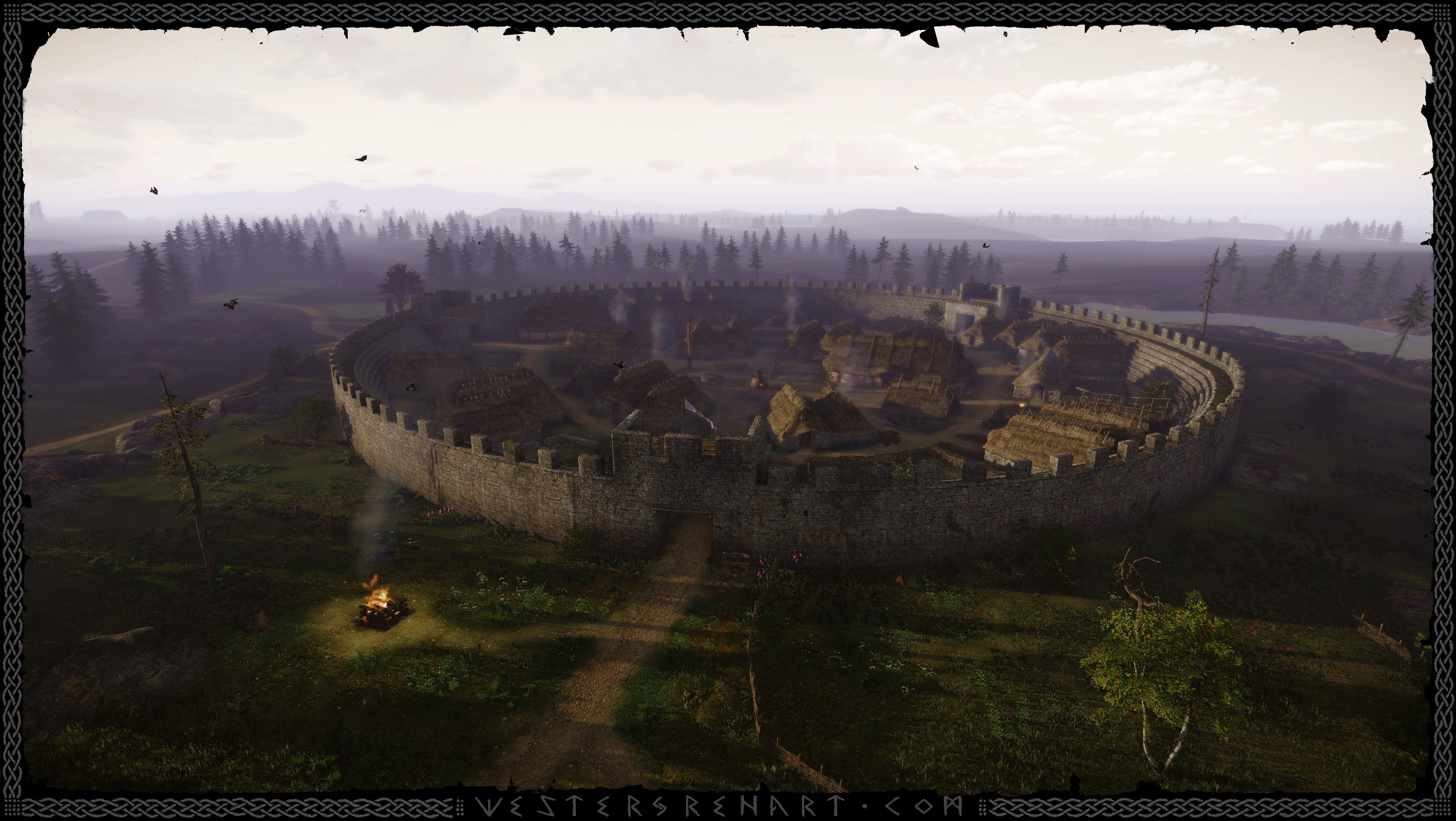
Looking northwest over my version of Iron Age Ismantorp, beyond which you can actually make out the great hall of Uppsala and the mounds in the distance. I based the crenelated design on Eketorp (see below reconstruction) but used a google map top view of the Ismantorp ruins to block out the fort and the buildings within. I am not certain what Ismantorp looked like, but some of the better preserved masonry match Eketorp's and the forts coexisted. Ismantorp is about 50 percent larger than Eketorp.
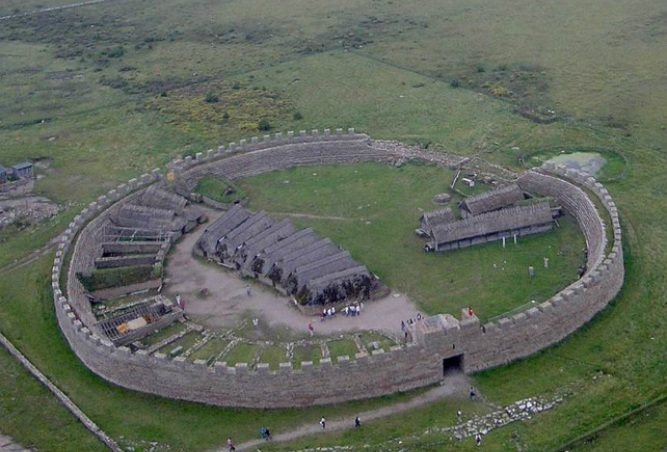
The reconstruction of Eketorp was built in the 1970s on top of the ancient ruins, using stones from the ruins as the bottom layers of the wall. It is built according to the second phase (400-650AD) but has some houses reconstructed from the third phase (1170-1240AD) - wooden houses on the right above. More info on Eketorp can be seen in this neat video by BirkaViking -
Some pyre burning in the sunset.

I'm calling this Ismantorp, but it is really more of an unnamed fort similar to it. The real Ismantorp had nine gates which would have been a defensive weakness and it may have been a more open marketplace than a fortress.
These fortified walls surround the quaint peasant town and protect the denizens from raiders. In the late 6th century this town already has at least 300 years of history and is a well-established landmark. There are new houses being built and lingering remnants of old foundations. I currently have only four houses but ideally I'd like most houses to be unique.
These fortified walls surround the quaint peasant town and protect the denizens from raiders. In the late 6th century this town already has at least 300 years of history and is a well-established landmark. There are new houses being built and lingering remnants of old foundations. I currently have only four houses but ideally I'd like most houses to be unique.

I had a very specific pattern I wanted for the dry stone wall and I found it difficult to get those very fine deep cracks right with displacement maps. Having grout filling in the cavities would require less tessellation but unfortunately they didn't use grout. The wall pieces ended up being pretty tessellated but it does make some nice silhouettes up close and LODs well at a distance.
I'm impressed with how CryEngine renders an entire fort filled with individual assets as well as the surrounding forests and some 6 km viewing distance beyond at 25-30 fps… And that's on a pretty slow PC. I haven't even done any optimization work yet.
I'm impressed with how CryEngine renders an entire fort filled with individual assets as well as the surrounding forests and some 6 km viewing distance beyond at 25-30 fps… And that's on a pretty slow PC. I haven't even done any optimization work yet.

To the east of Uppsala is the Stockholm archipelago, in real-life about 50 km distant - in my map about 2 km.
Eventually there should be more islands and variation and the flora should be a bit more subdued with trees twisted by the elements.
Eventually there should be more islands and variation and the flora should be a bit more subdued with trees twisted by the elements.

Above is a small outpost manning one of the beacons in the signal system that warns about impending attacks from ocean raiders.
Well, that's it for now. As usual, these images are WIP. Pretty much everything needs polishing and there's a lot more work to get the right feel of these places. Keep a lookout for more updates..
Hope you like and thanks for stopping by!
Feel free to drop me a line if you have any questions or comments.
 RSS Feed